Northwest Frontier Province of Pakistan

This map is centered on the Northwest Frontier Province of Pakistan ("NWFP").

The red lines are international borders. The blue lines are rivers.
King Abdul Rehman
King Abdul Rehman

At the top is the former Soviet Republic of Tajikistan. Below that in between two red lines in the Wakhan Corridor of Afghanistan. Notice that it reaches east to touch China. This is an artificial boundary created by the Treaty of St. Petersburg, a treaty between Russia and England. The idea was to set up Afghanistan as a "buffer state". The British were afraid that the Russian Army would cross the Hindu Kush and Himalayan Mountains and invade the heartland of India. To allay this fear, a treaty was made. The British would not interfere if Russia attacked and conquered everything north of what became Afghanistan. The British could have everything south and east of Afghanistan. Afghanistan, which had been under British occupation and had been the subject of three wars, would be independent.

Pursuant to this treaty, King Abdul Rehman of Afghanistan, who was in prison in Russia, was released from jail and allowed to return to rule Afghanistan, where he promptly invaded and conquered Kafirstan, which he renamed Nuristan. In his memoirs, Abdul Rehman wrote that the reason he invaded Kafirstan was that the Kafirstanis were such savages that, whenever they came to Kabul, they sold their wives as slaves.
Afghanistan, Pakistan, India, China and Tajikistan
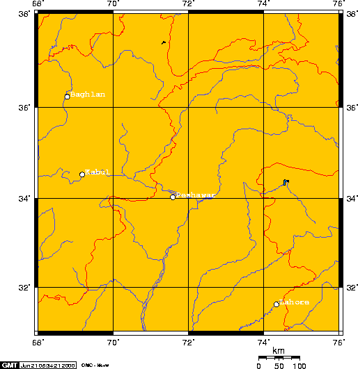
Baghlan on the map is not a city but a Soviet Air Base which was the center of intense fighting during the War in Afghanistan

Chitral became a special case. Chitral is where the two lines, 36 and 72, cross. The King of Chitral, Aman-ul-Mulk, did not want to be part of Afghanistan, so he requested to join the British Empire, provided of course that the British pay him an annual fee or tribute. In return for this money, Aman-ul-Mulk agreed not to attack Yasin, which is in Gilgit, again.

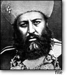
King Aman-ul-Mulk was the great-great-great-great-grandfather of my daughter, Shamema Honzagool, who was kidnapped in 1990 by members of the Jerry Falwell Organization.

In 1892, the British agreed to pay tribute and Chitral became part of the British Empire. However, when the king died, his sons started fighting and killing each other to become the next king, knowing that whomever was the king would receive this annual payment from the British.

This led to the famous "Siege of Chitral" and an Invasion by the British Army in 1895.

Peshawar, Pakistan is located at 34° 1' N 71° 35' E . Chitral is 180 miles north and a bit east of Peshawar. Honzagool lives 29 miles southwest of Chitral town.

Peshawar, Pakistan
Location: 34:00:00N 71:30:48E
Kabul, Afghanistan
Location: 34:34:01N 69:13:01E

Chitral town is at approximately 36:00:00N 72:00:00E or Long 71.807 Lat 35.882

Here are links:

Contact address - please send e-mail to the following address: Sloan@ishipress.com