This photo was taken by Henrik Liljegren
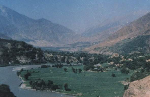
Do not let that river fool you. You do not see anybody swimming in it, do you? I have never seen anybody swimming in it either. The Chitral River is a much stronger and more powerful river than it seems to be. A little boy fell into it once and was never seen again. It is believed that his body was taken down by the river into Afghanistan. The river flows into Afghanistan and goes down to Jalalabad. In Afghanistan, it is known as the Kunar River.
 This photo was taken by Henrik Liljegren |
The building in the right center of the photo is the Village of Kalkatak and the House of Prince Mohay-ud-Din, a Former Minister of State of Pakistan. That is across the river from the house of Honzagool and the river is un-crossable there. There are bridges that cross the river five miles down or three miles up, however.
In forefront of the house of Prince Mohay-ud-Din but on the near side of the river you will see with difficulty a clump of houses. In the foreground is a row of houses. In the middle is the house of Honzagool. Behind them are more houses and Village Damik.
This picture is pointed down the river and SouthWest towards Afghanistan. Afghanistan is 30 miles downstream but less than eight miles away crossing the mountain passes to the right. To the right and out of sight is Jinjoret Valley and Jinjoret Stream. Up Jinjoret Stream are more villages, where the Kalash of Jinjoret Kuh lived. Further up is a high mountain pass which crosses into Afghanistan. During the War in Afghanistan, the Afghan Freedom Fighters and Refugees used to cross that pass. The Soviets dropped mines from the air and tried to close it, without success. As a result, every day there was a constant stream of Afghan refugees who had crossed that pass from Afghanistan and were now walking past the house of Honzagool.
Further down stream and out of sight is another village named Swir. It was there that the Soviets dropped bombs and killed several villagers. There is a valley to the right named Urtsun which provides another route to Afghanistan. In the Winter, Jinjoret Pass, which is 14,000 feet high, is difficult to cross because of snow, so the refuges come by way of Urtsun instead.
On the left side of the river and beyond Kalkatak Village is a village named Mirkani, which is at the mouth of a valley leading to Lowari Top, which is a 10,230 foot high pass which leads into Dir the rest of Pakistan. When I came to Chitral in 1980 and subsequently married Honzagool, I crossed Lowari Top by foot because it was February and Lowari Top is closed by snow at that time of year. In September, 1983, when I needed to get to the House of Honzagool without being detected by the police and border guards, I crossed Lowari Top on foot again. However, rather than take the main road, I used paths along the sides of the mountains, thereby evading detection. In so doing, I proved that it is entirely possible to get into and out of Pakistan without being detected by the Border Patrol. The newspapers of Pakistan later reported that I had entered Chitral by way of Afghanistan with a band of Mujahidin. This was not true. I had come alone on foot and had not crossed Afghanistan. Nowadays, the press is wondering what happened to Osama bin Laden and the Taliban. Probably they are not here, but most likely they have used one of the many similar passes to escape from Afghanistan into Pakistan. It is unlikely that they came by way of Jinjoret or Urtsun. However, Ahmed Shah Masood used to come this way all the time. More likely is that Osama escaped by way of Pakhtia and Parachinar. If you look at the terrain, you will see why it is so difficult to catch him.
Haji Ismail Sloan
Here are links: